

Post by denney on Oct 16, 2006 18:02:27 GMT -5
GREAT AMERICAN DRIVES
Lewis & Clark
The Trail. The trials. The tribulations.
On the eve of the bicentennial, a road version of their trip raises the question: Is there a better way to go?
By Alan Solomon
Tribune staff reporter
July 28, 2002
ILWACO, Wash. -- What Meriwether Lewis, William Clark and the gang did, starting in 1803 and finishing up three years later, was amazing. No question about it.
As a successful exercise in science, diplomacy and courage, nothing in American history comes close to the Lewis and Clark Expedition.
So with that in mind--and with all kinds of bicentennial celebrations poised to begin next year--it seemed like time to take on the Lewis and Clark National Historic Trail. Seemed like a great idea. Seemed.
Folks, before you consider this--well, let's start with South Dakota:
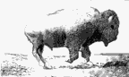
South Dakota has some of the coolest tourism things in the United States: Mt. Rushmore, the Badlands, the Black Hills, Wind Cave, herds of bison, the Corn Palace, Crazy Horse Memorial, Wall Drug, Deadwood and more.
The Lewis and Clark National Historic Trail goes to none of them.
It doesn't go to Yellowstone or Glacier National Park, or to the Little Big Horn, or to the Grand Tetons. Doesn't even tickle Colorado.
It goes over a lot of brown grass.
Not only that: Unless you travel by canoe or kayak or keelboat or some combination of the above, your trail won't be Lewis and Clark's trail. Except where they absolutely had to, they stayed on rivers, most notably the Missouri and the Columbia.
You, on the other hand, will be on roads, most of them miles from flowing water. Some of them dirt. Most of them tedious.
Not only that: Even the rivers aren't what they were. The Missouri, thanks to dams every few feet, has in large part turned into the World's Longest Lake.
The Great Falls that forced this Corps of Discovery to portage in Montana? For much of the year, they're reduced to a Great Trickle. The rapids on the Columbia that sent canoes smashing against rocks? Thanks to the Bonneville Dam, they're somewhere under water.
In other words, even if you're a huge fan of Lewis and Clark and Indian heroine Sacagawea and faithful puppy Seaman, sticking to the various official routes marked by the National Park Service and their state-agency accomplices (No, there isn't just one way out and another way back--another challenge to navigating this thing.) may leave you disappointed and unnecessarily exhausted. Kind of like the previous sentence.
But there are some memorable moments along the Lewis and Clark National Historic Trail. Some of them have everything to do with Lewis or Clark, others nothing at all.
So here it is . . . after a real quick briefing on what the Trail is all about:
In 1803, President Thomas Jefferson authorized sending Lewis and Clark and, ultimately, a party of 43 others (including Clark's slave, York, but not counting Lewis' Newfoundland dog, Seaman) on a mission to find a water passage from the Missouri River to the Pacific.
They moved down the Ohio in 1803 and started up the Missouri in 1804. In 1805, at Ft. Mandan in North Dakota, this Corps of Discovery--reduced to 33, plus an infant and the dog--headed toward the Rockies. Included now was an Indian woman (and new mom) named Sacagawea, whose contribution as interpreter and guide would be immeasurable.
They didn't find the Northwest Passage, mainly because there isn't any; but they did reach the Pacific, and on the way collected all kinds of information and tales, much of it recorded in journals by Lewis, Clark and several members of the Corps.
There's more to this story--including subtleties, danger, threats, bad weather, bears, Clark being shot in the backside, stolen horses, surprising votes and three deaths--but that's why people write 521-page books.
We do this.
OK, let's get on with it.
Day 1: Camp Dubois to Leavenworth, Kan.
On May 14, 1804, they set off--all except Lewis, who was tying up some loose ends in St. Louis--from Illinois and their base camp near present-day Hartford, where the meager Dubois River emptied into the mighty Mississippi.
Today, two people are fishing at what Clark called "the point of departure." A monument marks the spot, just off Illinois Highway 3 north of East St. Louis.
"You can never tell what you're going to catch here," says angler Jerry Brown, who grew up nearby. "You could catch anything.
"I'll tell you what," says Brown. "Those guys had some guts in those days . . . "
Except it turns out those guys didn't start from here at all. This isn't the Riviere du Bois. This is a drainage ditch from Cahokia, Ill. The designated "point of departure" is a fake. "This site," explains historian Don Hastings, "was selected as being the best site to replicate conditions of 1803-04."
The real Camp Dubois, says Hastings, of the very promising soon-to-open museum near here, is probably under water. Rivers, like human events, change course.
Our course will take us north into historic Alton and across the Mississippi. Our first look at the Missouri River will come about five miles later. It won't be pretty.
"The landscape," cautions many National Park Service markers, "has changed since Lewis and Clark explored it . . . "
Lewis rendezvoused with Clark and the rest of the Corps of Discovery at St. Charles, which would be Missouri's first state capital (1821-26). "They bought up all the tobacco in town," says Jim Rascher, "went to a church service [the church is gone] and headed up the river."
So will Rascher. He's part of a team that will reenact the whole journey. "The same time frame," he says, "as close as we can match their dates without somebody being injured."
The river dips south from St. Charles. Highways follow it some of the way. Mine doesn't. I meet it again near Arrow Rock, another historic town, then stay with it, more or less, on U.S. Highway 24.
The Lewis and Clark Trail signs sucker me into staying on U.S. 24. It is slow. It cuts through Independence and past the Harry S. Truman Library, but now there isn't time to stop; through some of the least attractive neighborhoods of both the Missouri and Kansas sides of Kansas City; and finally to a road that will take me into Leavenworth, Kan.
The one with the prison.
DAY 2: Leavenworth to Vermillion, S.D.
The "Birdman of Alcatraz," Robert Stroud, didn't become a birdman until he got to Leavenworth, where he did his last 30 years' worth of time--but who would buy tickets to "Birdman of Leavenworth"?
OK, back to Lewis and Clark.
The prison is on this side of the Missouri, and so is Ft. Leavenworth, an Army base where the kids attend Gen. George S. Patton Junior High School.
The Corps of Discovery camped on the other side of the Missouri, in Missouri. Nonetheless, the Frontier Army Museum on the base in Kansas does feature Lewis and Clark in a small exhibit that includes a statue of the two. The men aren't identified. A staffer clears it up.
"Lewis," he says, "is the one with the slightly receding hairline."
Atchison, Kan., is 25 miles up the road. Aviator Amelia Earhart was born in Atchison; she's honored in the town's museum--the old depot for the Atchison, Topeka and Santa Fe, which is a song lyric.
"At one time," says a museum worker, "there was a video. You could press a button and punch it up." The TV set is still there and a VCR. The tape is missing.
But Lewis and Clark did camp here, on the Fourth of July, 1804. In tribute, they and the boys had a few pops and fired a cannon on the riverbank that's now part of Independence Park.
Back on the road.
St. Joseph, Mo., isn't doing real well. Jobs have fled. This is a city with plenty of history (the Pony Express was born here, Jesse James was killed here), and museums to match--but it needs help.
The St. Joseph Museum has a room devoted to Lewis and Clark. A Lewis and Clark campsite in Riverfront Park is marked by a National Park Service sign and a dead casino boat. Interstate Highway 229 roars overhead.
The landscape has changed since Lewis and Clark explored it . . .
I head north again.
The Western Historic Trails Center, on the edge of Council Bluffs, Iowa, is one of the good museums, including a little on Lewis and Clark. A few miles north of the museum, on a bluff above Council Bluffs, is a monument marking the spot where the boys first met with Indians--hence, the name. Except there's this problem.
"The monument's a bald-faced lie," says museum guide Ryan Roenfeld. "Lewis and Clark didn't meet with the Indians there. They looked, but they couldn't find them."
They found them in Nebraska. I skip the monument.
Lewis & Clark
The Trail. The trials. The tribulations.
On the eve of the bicentennial, a road version of their trip raises the question: Is there a better way to go?
By Alan Solomon
Tribune staff reporter
July 28, 2002
ILWACO, Wash. -- What Meriwether Lewis, William Clark and the gang did, starting in 1803 and finishing up three years later, was amazing. No question about it.
As a successful exercise in science, diplomacy and courage, nothing in American history comes close to the Lewis and Clark Expedition.
So with that in mind--and with all kinds of bicentennial celebrations poised to begin next year--it seemed like time to take on the Lewis and Clark National Historic Trail. Seemed like a great idea. Seemed.
Folks, before you consider this--well, let's start with South Dakota:
South Dakota has some of the coolest tourism things in the United States: Mt. Rushmore, the Badlands, the Black Hills, Wind Cave, herds of bison, the Corn Palace, Crazy Horse Memorial, Wall Drug, Deadwood and more.
The Lewis and Clark National Historic Trail goes to none of them.
It doesn't go to Yellowstone or Glacier National Park, or to the Little Big Horn, or to the Grand Tetons. Doesn't even tickle Colorado.
It goes over a lot of brown grass.
Not only that: Unless you travel by canoe or kayak or keelboat or some combination of the above, your trail won't be Lewis and Clark's trail. Except where they absolutely had to, they stayed on rivers, most notably the Missouri and the Columbia.
You, on the other hand, will be on roads, most of them miles from flowing water. Some of them dirt. Most of them tedious.
Not only that: Even the rivers aren't what they were. The Missouri, thanks to dams every few feet, has in large part turned into the World's Longest Lake.
The Great Falls that forced this Corps of Discovery to portage in Montana? For much of the year, they're reduced to a Great Trickle. The rapids on the Columbia that sent canoes smashing against rocks? Thanks to the Bonneville Dam, they're somewhere under water.
In other words, even if you're a huge fan of Lewis and Clark and Indian heroine Sacagawea and faithful puppy Seaman, sticking to the various official routes marked by the National Park Service and their state-agency accomplices (No, there isn't just one way out and another way back--another challenge to navigating this thing.) may leave you disappointed and unnecessarily exhausted. Kind of like the previous sentence.
But there are some memorable moments along the Lewis and Clark National Historic Trail. Some of them have everything to do with Lewis or Clark, others nothing at all.
So here it is . . . after a real quick briefing on what the Trail is all about:
In 1803, President Thomas Jefferson authorized sending Lewis and Clark and, ultimately, a party of 43 others (including Clark's slave, York, but not counting Lewis' Newfoundland dog, Seaman) on a mission to find a water passage from the Missouri River to the Pacific.
They moved down the Ohio in 1803 and started up the Missouri in 1804. In 1805, at Ft. Mandan in North Dakota, this Corps of Discovery--reduced to 33, plus an infant and the dog--headed toward the Rockies. Included now was an Indian woman (and new mom) named Sacagawea, whose contribution as interpreter and guide would be immeasurable.
They didn't find the Northwest Passage, mainly because there isn't any; but they did reach the Pacific, and on the way collected all kinds of information and tales, much of it recorded in journals by Lewis, Clark and several members of the Corps.
There's more to this story--including subtleties, danger, threats, bad weather, bears, Clark being shot in the backside, stolen horses, surprising votes and three deaths--but that's why people write 521-page books.
We do this.
OK, let's get on with it.
Day 1: Camp Dubois to Leavenworth, Kan.
On May 14, 1804, they set off--all except Lewis, who was tying up some loose ends in St. Louis--from Illinois and their base camp near present-day Hartford, where the meager Dubois River emptied into the mighty Mississippi.
Today, two people are fishing at what Clark called "the point of departure." A monument marks the spot, just off Illinois Highway 3 north of East St. Louis.
"You can never tell what you're going to catch here," says angler Jerry Brown, who grew up nearby. "You could catch anything.
"I'll tell you what," says Brown. "Those guys had some guts in those days . . . "
Except it turns out those guys didn't start from here at all. This isn't the Riviere du Bois. This is a drainage ditch from Cahokia, Ill. The designated "point of departure" is a fake. "This site," explains historian Don Hastings, "was selected as being the best site to replicate conditions of 1803-04."
The real Camp Dubois, says Hastings, of the very promising soon-to-open museum near here, is probably under water. Rivers, like human events, change course.
Our course will take us north into historic Alton and across the Mississippi. Our first look at the Missouri River will come about five miles later. It won't be pretty.
"The landscape," cautions many National Park Service markers, "has changed since Lewis and Clark explored it . . . "
Lewis rendezvoused with Clark and the rest of the Corps of Discovery at St. Charles, which would be Missouri's first state capital (1821-26). "They bought up all the tobacco in town," says Jim Rascher, "went to a church service [the church is gone] and headed up the river."
So will Rascher. He's part of a team that will reenact the whole journey. "The same time frame," he says, "as close as we can match their dates without somebody being injured."
The river dips south from St. Charles. Highways follow it some of the way. Mine doesn't. I meet it again near Arrow Rock, another historic town, then stay with it, more or less, on U.S. Highway 24.
The Lewis and Clark Trail signs sucker me into staying on U.S. 24. It is slow. It cuts through Independence and past the Harry S. Truman Library, but now there isn't time to stop; through some of the least attractive neighborhoods of both the Missouri and Kansas sides of Kansas City; and finally to a road that will take me into Leavenworth, Kan.
The one with the prison.
DAY 2: Leavenworth to Vermillion, S.D.
The "Birdman of Alcatraz," Robert Stroud, didn't become a birdman until he got to Leavenworth, where he did his last 30 years' worth of time--but who would buy tickets to "Birdman of Leavenworth"?
OK, back to Lewis and Clark.
The prison is on this side of the Missouri, and so is Ft. Leavenworth, an Army base where the kids attend Gen. George S. Patton Junior High School.
The Corps of Discovery camped on the other side of the Missouri, in Missouri. Nonetheless, the Frontier Army Museum on the base in Kansas does feature Lewis and Clark in a small exhibit that includes a statue of the two. The men aren't identified. A staffer clears it up.
"Lewis," he says, "is the one with the slightly receding hairline."
Atchison, Kan., is 25 miles up the road. Aviator Amelia Earhart was born in Atchison; she's honored in the town's museum--the old depot for the Atchison, Topeka and Santa Fe, which is a song lyric.
"At one time," says a museum worker, "there was a video. You could press a button and punch it up." The TV set is still there and a VCR. The tape is missing.
But Lewis and Clark did camp here, on the Fourth of July, 1804. In tribute, they and the boys had a few pops and fired a cannon on the riverbank that's now part of Independence Park.
Back on the road.
St. Joseph, Mo., isn't doing real well. Jobs have fled. This is a city with plenty of history (the Pony Express was born here, Jesse James was killed here), and museums to match--but it needs help.
The St. Joseph Museum has a room devoted to Lewis and Clark. A Lewis and Clark campsite in Riverfront Park is marked by a National Park Service sign and a dead casino boat. Interstate Highway 229 roars overhead.
The landscape has changed since Lewis and Clark explored it . . .
I head north again.
The Western Historic Trails Center, on the edge of Council Bluffs, Iowa, is one of the good museums, including a little on Lewis and Clark. A few miles north of the museum, on a bluff above Council Bluffs, is a monument marking the spot where the boys first met with Indians--hence, the name. Except there's this problem.
"The monument's a bald-faced lie," says museum guide Ryan Roenfeld. "Lewis and Clark didn't meet with the Indians there. They looked, but they couldn't find them."
They found them in Nebraska. I skip the monument.
 thank you for allowing me access to this site.